
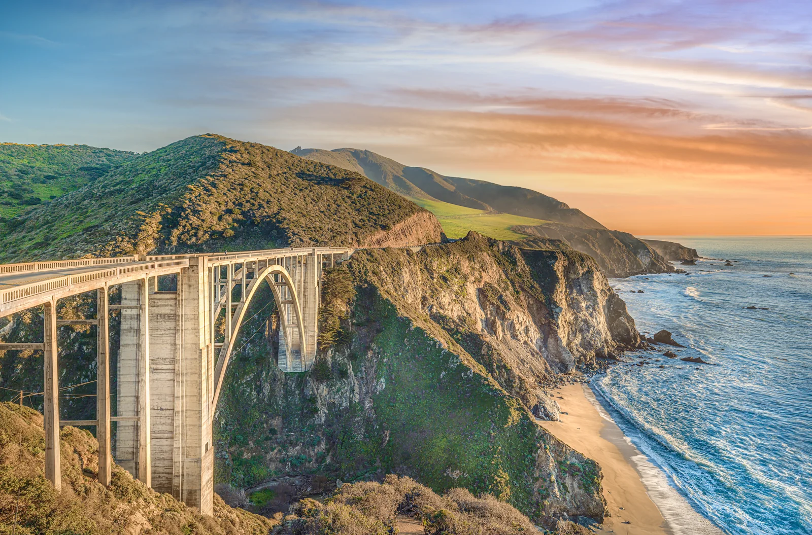
Bixby Creek Bridge sits on Highway 1 about thirteen miles south of Carmel-by-the-Sea, California, and it is the most photographed thing on this coast. I have been photographing it for twenty years, I printed one frame of it 72 inches wide for a client's wall, and I have stood at every turnout in every kind of light. This is the guide I wish someone had handed me the first time: the three places to stand, the light by season, where to park without a ticket, and the one view of this bridge that even sixty-year locals have never seen.
Where to stand
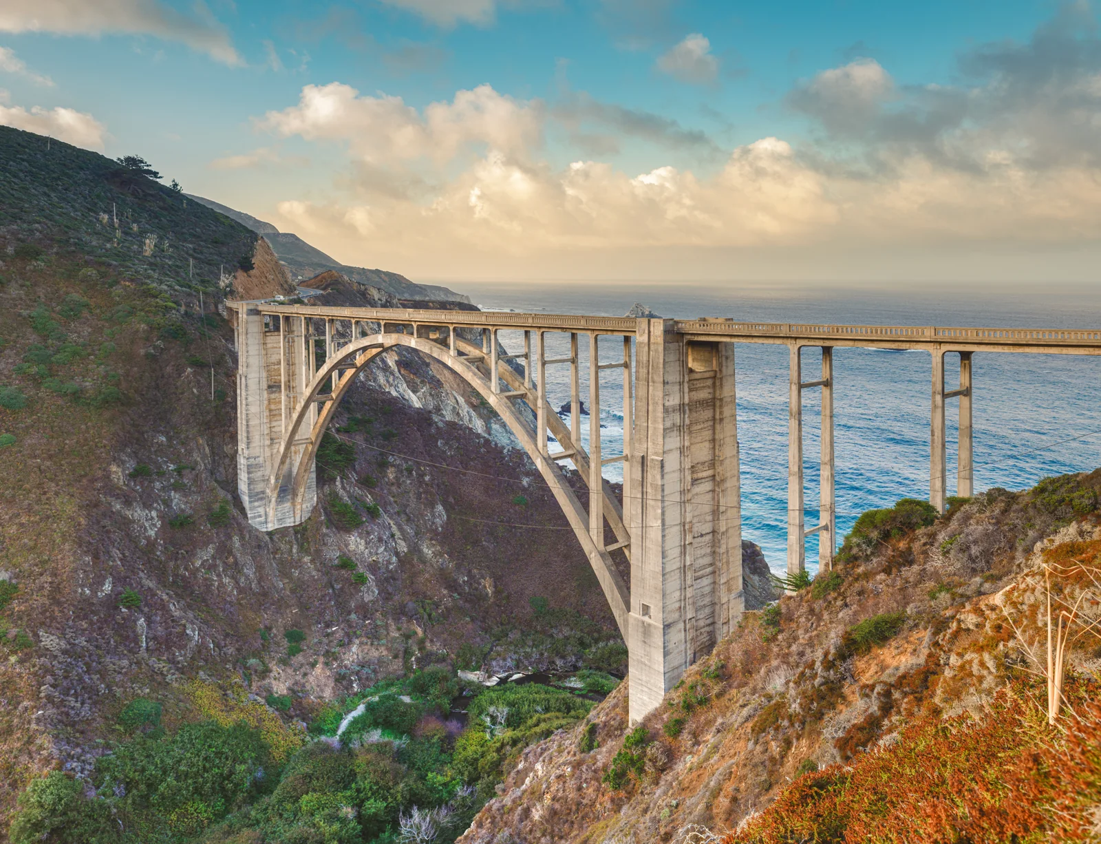
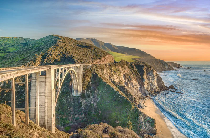
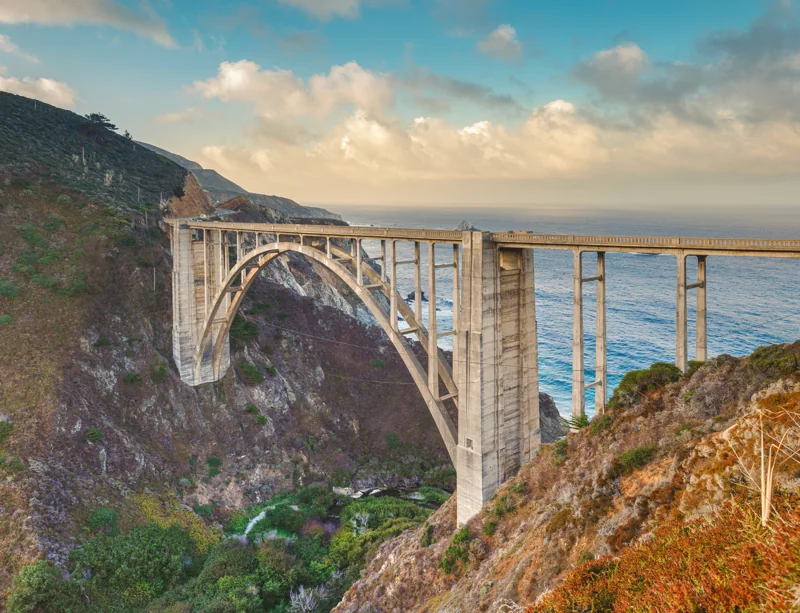
There are three real viewpoints and you can cover all of them in ten minutes. The first is the Castle Rock Viewpoint, the turnout on the inland side of Highway 1 at the north end of the bridge. This is the postcard: the arch in the foreground, the coastline running south to the headlands, and the little beach at the mouth of Bixby Creek that you cannot get down to. My sunset sweep at the top of this page was made here. The second is the Old Coast Road, the dirt road that leaves Highway 1 at the same north end. Walk up the first few hundred feet and you are higher and closer, looking at the arch almost side-on, with the formwork lines in the concrete visible when the light rakes across it. The third is Hurricane Point, the big turnout about a mile south. From there you look back north at the whole bridge set against the headlands, which is the frame that shows how high the thing actually is.
When to go
Sunset, and specifically the last forty minutes. The bridge faces west, so that is when the face of the arch turns gold and the water underneath goes from grey to blue. Arrive an hour early, because the turnouts fill, and stay fifteen minutes after the sun is gone, because the sky does its best work then and most people have already left.
By season: winter is the best-kept secret. From December through March the air is clearest after storms, the sun sets over the water instead of behind the headland, and the hills turn green from January into April. Summer afternoons are reliable but the hills are brown and the light is hazy. Summer mornings bring the marine layer, which is a problem if you are standing in it and a gift if you are standing above it, which brings me to the picture below.
The view almost nobody has seen
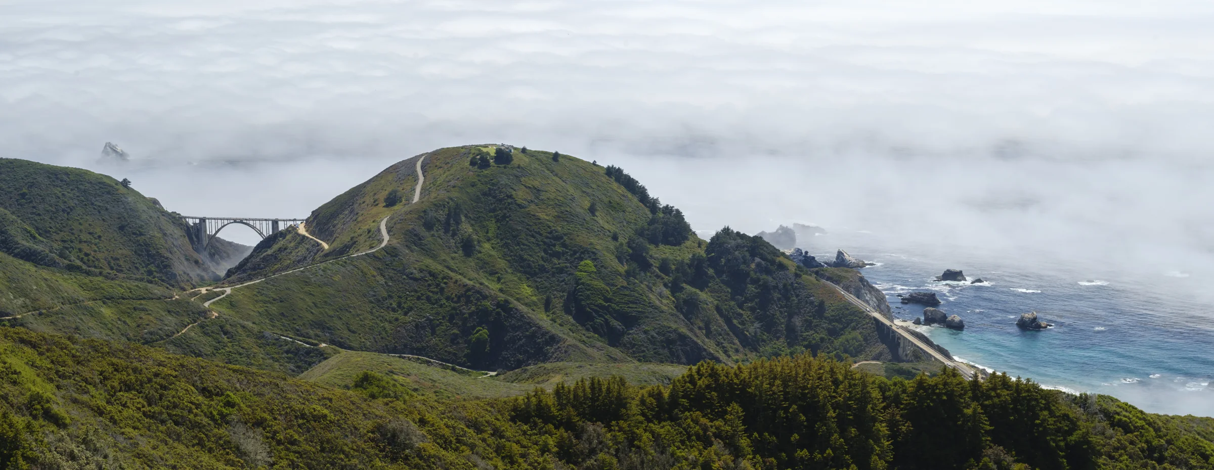
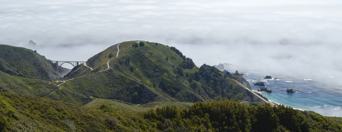
Driving south from Carmel you cross Rocky Creek Bridge first, a mile before Bixby. It was built the same year, 1932, in the same open-spandrel style, and every week someone photographs it thinking it is Bixby. From the highway you can never see both at once. From private land high above the Old Coast Road, on a summer morning with the marine layer sitting on the ocean below, you can. Bixby is the arch on the left, Rocky Creek is the lower bridge on the right, and between them is the ridge that the Old Coast Road climbs.
When I had my gallery in Sand City this panorama hung on the main wall. A visitor who had lived on the Monterey Peninsula for sixty years and drives to Big Sur regularly stood in front of it for a long time and then asked me where it was. He had never seen it. Nobody has, unless they have been on that land. That is what makes it the rarest piece in my collection, and it is why it prints so well wide: as a panorama it runs to 62 inches across at 24 inches tall without losing anything.
Parking, safety and the things that get you a ticket
The Castle Rock turnout holds maybe twenty cars and at sunset it is full. People park on the shoulder of Highway 1 and the CHP writes them up. Come early or use Hurricane Point, which is bigger. Do not cross the highway without looking both ways twice; the cars come around the curve at fifty. Stay behind the barriers. Every classic frame of this bridge is made from behind a rail, and the cliff on the other side of it is 280 feet straight down. Leave the drone at home. The wind, the crowds and the local feeling about drones along this stretch all argue against it, and I have never flown one here.
How I photograph it
Medium format, a Fujifilm GFX 100 II at 102 megapixels, on a tripod, because the whole point of this bridge is to print it large. A wide lens from the viewpoint for the sweep, a longer one from the Old Coast Road to compress the arch against the headland. I bracket the last light because the sky and the shadowed canyon are five stops apart. In the edit, restraint: the evening already looks like this, and the job is to keep it that way. I print in my own studio in Carmel-by-the-Sea on a 64-inch Epson, on cotton rag, canvas, aluminum or acrylic, and I have printed Bixby at 72 inches wide for a client who wanted the whole wall.
The Bixby prints
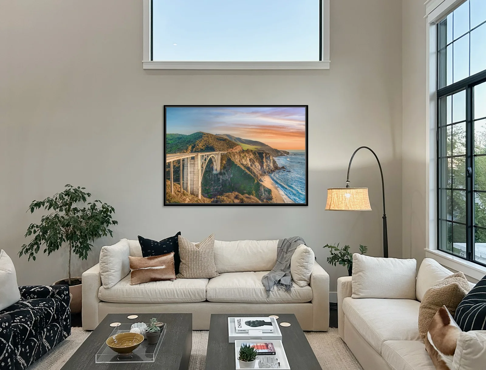
Three pieces, each printed to order and each for sale. On canvas, $950 at 16 by 20 inches, $1,650 at 24 by 30, $2,900 at 32 by 40, $4,800 at 40 by 60 and $7,500 at 64 inches wide, which is the size in the living room above. Archival paper is the same price, aluminum and acrylic face mount cost more, and the panorama is quoted by size. Not sure which size? Send me a photo of your wall with one measurement and I will send back a mockup at true scale, free, usually the same day. That is how the living room above was sized. Then pick the piece on the prints page or call me.
Where is the best place to photograph Bixby Bridge?
The Castle Rock Viewpoint turnout at the north end of the bridge, on the inland side of Highway 1, gives the classic view: the arch, the coastline running south and the beach at the mouth of Bixby Creek. A few steps up the start of the Old Coast Road, which leaves Highway 1 at the same north end, puts you higher and closer to the arch. Hurricane Point, the big turnout about a mile south, looks back north at the whole bridge against the headlands. All three are free and take ten minutes to cover.
What time of day is best for photos of Bixby Bridge?
Sunset, in the last forty minutes before the sun goes down, when the west face of the arch turns gold and the ocean goes blue. Mornings are backlit and often foggy, which is its own picture when the fog sits below you. Midday is flat and crowded. Winter, from December through March, gives the clearest air and the sun setting over the ocean rather than behind the headland, and the hills are green from January into April.
Can I fly a drone at Bixby Bridge?
I do not, and I would not. The turnouts are packed with people, the wind off the ocean is unpredictable, Big Sur's state parks ban drones, and the community has pushed hard against them along this stretch of Highway 1. My aerial views of the Big Sur coast are made from a helicopter, with a pilot, as part of commissioned aerial work.
Can I buy a print of Bixby Bridge?
Yes. Three Bixby pieces are in my print collection: the sunset sweep with the beach, the close view of the arch at last light, and the rare panorama of Bixby and Rocky Creek bridges together above the fog. On canvas it starts at $950 for 16 by 20 inches, runs to $4,800 for 40 by 60 and $7,500 at 64 inches wide, with archival paper, aluminum and acrylic face mount also available. The largest Bixby I have printed was a 72-inch giclée, by request. Every print is made in my own studio in Carmel-by-the-Sea, California.
Is Rocky Creek Bridge the same as Bixby Bridge?
No, and people mix them up every day. Rocky Creek Bridge is about a mile north of Bixby on Highway 1, built the same year, 1932, in the same open-spandrel concrete arch style, just smaller. Driving south from Carmel you cross Rocky Creek first. The only place I know where you can see both bridges in one frame is from private land above the Old Coast Road, which is where my two-bridge panorama was made.